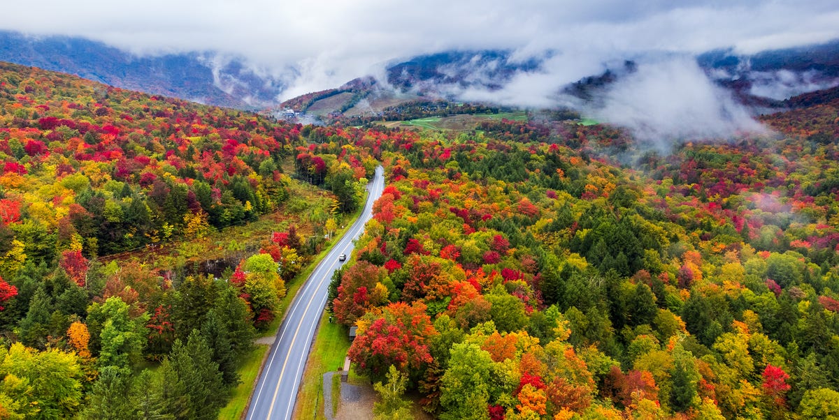
Fall has a funny way of turning ordinary adults into people who suddenly say things like, “Let’s drive four hours to look at trees.” And honestly? Fair. When the maples go scarlet, the aspens shimmer gold, and the oaks put on their copper jackets, America becomes one giant outdoor art gallery. That is why the new fall foliage map from The Old Farmer’s Almanac is getting attention from leaf peepers, road-trippers, photographers, hikers, and anyone who believes a cider doughnut tastes better when eaten near a covered bridge.
The latest map helps travelers estimate when leaves are expected to reach peak color across the United States. It is not a crystal ball, but it is a very useful seasonal planning tool. The map shows how fall color typically rolls from north to south, higher elevations to lower valleys, and cooler regions to warmer ones. In 2025, weather patterns such as a warm summer and dry stretches in parts of the country have made timing especially important, because drought and heat can push leaves to change early, fade faster, or drop before everyone has finished posing in flannel.
So, what does the map mean for your fall travel plans? In simple terms: do not wait too long, check regional updates before you go, and understand that peak foliage is more of a short performance than a long-running Broadway show. In many places, the best color may last only about a week to ten days. Blink, and the red maple you came to admire may be lying dramatically on the sidewalk.
What the New Farmer’s Almanac Fall Foliage Map Shows
The fall foliage map breaks the country into color stages, helping readers see where leaves are just beginning to turn, where they are approaching peak, where peak color is happening, and where the season has already passed. This kind of visual guide is especially helpful because fall color does not arrive everywhere at once. Northern Maine may be blazing with color while Georgia is still mostly green. Colorado’s high-country aspens can shine in September, while lower-elevation areas in the Southeast may keep changing into November.
According to the map’s general pattern, northern states and higher elevations usually lead the parade. New England, the Upper Midwest, the Rocky Mountains, and parts of the Pacific Northwest often see earlier color. The Mid-Atlantic, Appalachia, the Ohio Valley, and much of the Midwest tend to peak later in October. The South, lower elevations, and warmer regions often stretch the season into late October, November, or even early December in limited areas.
For travelers, the key takeaway is that fall foliage planning should be regional, not national. Searching “peak fall foliage near me” is useful, but combining that search with a national map, local foliage reports, weather updates, and elevation details is much better. A single state can have several different foliage calendars. New York, for example, tracks color across multiple vacation regions, and states like Vermont, Maine, and New Hampshire publish regular foliage updates because the difference between “nice color” and “peak color” can be just a few chilly nights.
Why Peak Fall Foliage Changes Every Year
Fall color looks magical, but the science behind it is very practical. Trees are preparing for winter. As days get shorter and nights become cooler, leaves stop producing as much chlorophyll, the green pigment that helps plants convert sunlight into food. Once chlorophyll fades, other pigments become visible. Carotenoids create yellows and oranges. Anthocyanins help produce reds and purples. Tannins contribute to browns and russet tones.
The most brilliant fall color often develops when autumn brings sunny days, cool nights, and enough moisture to keep trees healthy. Too much drought can stress trees, causing leaves to brown or fall early. Heavy rain and strong winds can shorten the display. Warm nights may delay the chemical changes that create dramatic color. In other words, trees are artists, but weather is the art director, and sometimes the art director is in a mood.
This is one reason fall foliage predictions are estimates rather than guarantees. A map can show likely timing based on seasonal patterns, historical data, current conditions, and regional knowledge. But a cold snap, windstorm, dry spell, or rainy weekend can change the show quickly. Smart leaf peepers use maps as a starting point, then check real-time local reports before booking hotels, planning scenic drives, or convincing the family that “just one more overlook” is a normal vacation activity.
When Leaves Are Expected to Peak Across the U.S.
While timing varies by year, the new foliage map follows the classic American autumn rhythm. Peak colors generally begin in the northernmost regions and mountain areas, then slide southward and downhill as the season progresses.
Early Fall: Late September to Early October
Some of the earliest peak color often appears in northern New England, the Adirondacks, the Upper Midwest, and high elevations of the Rockies. Western Maine, northern Vermont, northern New Hampshire, Michigan’s Upper Peninsula, northern Minnesota, and Colorado’s aspen country are classic early-season contenders. In the West, high-elevation areas can be spectacular but brief, especially when wind or snow arrives early.
This is also the time when serious leaf peepers start watching reports closely. Early color may look patchy at first, but a few cool nights can quickly transform hillsides. If you are planning a trip to the White Mountains, the Green Mountains, the Adirondacks, or Colorado’s mountain passes, late September and early October can be prime time.
Midseason Color: Early to Mid-October
Early to mid-October is often the sweet spot for many famous foliage destinations. New England reaches some of its most photogenic moments. The Catskills and Hudson Valley begin to glow. The Great Lakes region develops strong color. The Blue Ridge Mountains start showing elevation-based waves of red, orange, and gold.
This is also when crowds can become intense. Popular scenic roads, small towns, apple orchards, and mountain viewpoints may fill quickly, especially on weekends. Travelers who can visit on weekdays usually get a calmer experience, better parking, and fewer accidental appearances in other people’s engagement photos.
Late October: Appalachia, Midwest, and Lower Elevations
By late October, peak foliage often moves into lower elevations of the Appalachians, the Ohio Valley, parts of the Mid-Atlantic, the southern Rockies, and the central U.S. This is a wonderful window for travelers who missed the early northern peaks. Places like Pennsylvania, West Virginia, Virginia, Kentucky, Missouri, and parts of North Carolina and Tennessee may offer strong color around this period, depending on elevation and weather.
The Great Smoky Mountains are especially interesting because elevation creates a long foliage season. Higher ridges may peak earlier, while valleys and lower slopes hold color later. That means travelers can often chase color simply by changing altitude.
November and Beyond: The South and Warm Regions
In the Southeast, Texas, the lower Mississippi Valley, and parts of the coastal South, fall color typically arrives later and may be more subtle than in New England. But subtle does not mean boring. Cypress, sweetgum, oak, hickory, and maple can still create beautiful displays, especially along rivers, parks, and forested drives.
Some warmer regions may show color into November, and limited areas of Florida or the Gulf Coast may see late-season changes even later. Travelers should adjust expectations: southern fall foliage is often less about mountainsides blazing red and more about warm golds, russet oaks, glowing understory plants, and peaceful trails without the heavy northern crowds.
Best Places to See Peak Fall Foliage
The map is useful because it helps travelers decide not only when to go, but where to go. America has no shortage of autumn destinations, from famous postcard towns to underrated parks where you can actually find a parking spot.
New England
New England remains the heavyweight champion of fall foliage. Vermont’s Green Mountains, New Hampshire’s White Mountains, Maine’s inland forests and coastal routes, Massachusetts’ Berkshires, and Connecticut’s Litchfield Hills all offer classic autumn scenery. Covered bridges, village greens, farm stands, and historic inns add to the charm. It is the kind of place where even a gas station parking lot can look like a calendar photo if the lighting is right.
New York and the Mid-Atlantic
New York has one of the longest and most varied foliage seasons in the country. The Adirondacks usually start early, followed by the Catskills, Hudson Valley, Finger Lakes, and Long Island. Pennsylvania also offers impressive color, especially in the Poconos, Allegheny National Forest, and state parks such as Ricketts Glen. Maryland, New Jersey, and Delaware can surprise travelers with colorful parks and river valleys later in October.
The Blue Ridge and Great Smoky Mountains
The Blue Ridge Parkway is one of the best fall drives in the United States because it covers so many elevations and ecosystems. Virginia and North Carolina both offer long foliage windows, and the Great Smoky Mountains provide one of the richest tree-species mixes in the country. That diversity creates layered color: yellow birches, red maples, orange sourwoods, bronze oaks, and evergreen contrast all in one view.
The Midwest and Great Lakes
The Midwest deserves more foliage applause. Michigan’s Upper Peninsula, Wisconsin’s Door County, Minnesota’s North Shore, Ohio’s Cuyahoga Valley, and Missouri’s Ozarks can deliver excellent fall color without always carrying New England-level hotel prices. Lakes, bluffs, farms, and hardwood forests make this region ideal for scenic drives and weekend getaways.
The Rockies and the West
In the Rockies, aspens steal the show. Colorado, Wyoming, Utah, Idaho, and Montana often see gold aspen groves shimmering against dark evergreens and snow-dusted peaks. The season can be short, but the payoff is huge. Farther west, Oregon’s Columbia River Gorge, Washington’s mountain parks, California’s Sierra Nevada, and parts of Arizona and New Mexico offer impressive fall displays, especially where elevation creates cooler conditions.
How to Use the Fall Foliage Map Like a Pro
A foliage map is most powerful when paired with local information. Before traveling, check official state foliage reports, park updates, weather forecasts, and recent photos from visitor centers or tourism boards. Social media can help, but use it carefully. A viral photo from last year may send you to a viewpoint that currently looks like a salad.
Plan for flexibility. If your destination is not at peak yet, drive higher in elevation or farther north. If it is past peak, try lower elevations, valleys, river corridors, or nearby towns. Foliage chasing is part science, part luck, and part accepting that nature does not care about your hotel cancellation policy.
For photography, mornings and late afternoons usually offer softer light. Overcast days can make colors look richer by reducing harsh shadows. Rain can deepen bark and leaf tones, though it may also make trails slippery. Bring layers, comfortable shoes, water, snacks, and a backup plan. The best foliage trips often include more than leaves: farm markets, historic downtowns, hiking trails, scenic railways, apple orchards, pumpkin patches, and warm drinks that cost slightly too much but feel emotionally necessary.
Responsible Leaf Peeping Matters
Fall tourism brings major benefits to small towns, parks, restaurants, inns, and local shops. But it can also create problems when visitors block roads, trespass on private property, leave trash, or crowd fragile landscapes. Some popular locations have had to restrict access because social media attention overwhelmed narrow rural roads and residential areas.
The golden rule is simple: admire the view without becoming the problem in the view. Park only in legal spaces. Respect posted signs. Stay on trails. Do not walk into private fields or driveways for a photo. Support local businesses, be patient with traffic, and remember that real people live in the charming village you are photographing. Nothing ruins a cozy autumn mood faster than a tow truck and a lecture from someone’s very tired town constable.
Why This Year’s Map Is Especially Useful
The new Farmer’s Almanac-style foliage map is especially helpful because recent seasons have shown how unpredictable fall color can be. Drought, unusual warmth, heavy rain, storm systems, and shifting climate patterns can all influence the timing and brightness of autumn leaves. In some areas, dry conditions have caused muted color or early leaf drop. In others, healthy forests and timely cool nights have produced pockets of brilliant color even when broader conditions were less than perfect.
For travelers, this means a national map should be treated as a smart guide, not a fixed promise. It helps narrow the window. It gives you a strong starting point. But the best results come from checking conditions close to your travel date. A trip planned around the second week of October may be perfect in one region and too late in another. Local reports are the final word.
Experience Notes: What Leaf Peeping Feels Like in Real Life
There is something wonderfully old-fashioned about planning a fall foliage trip with a map. It feels slower than ordinary travel. You are not chasing a nightclub opening, a restaurant reservation, or the newest attraction with a suspiciously long line. You are chasing trees, which have been doing this seasonal performance long before anyone thought to rate it five stars online.
A good foliage day often starts before you expect it to. The morning air feels sharper. There may be fog low in the valleys, especially near rivers or mountain towns. The road curves through forests that look ordinary at first, then suddenly a hillside opens up and the whole landscape seems to be on fire in the safest possible way. Reds, oranges, golds, and greens overlap like stained glass. Everyone in the car becomes quiet for a second. Then someone says, “Pull over,” and the driver replies, “There is nowhere to pull over,” which is the traditional anthem of leaf peeping.
The best experiences are rarely rushed. A foliage trip is better when you allow time for small detours: a farm stand selling apples, a general store with maple candy, a roadside overlook, a short trail that was supposed to take 20 minutes but becomes an hour because every bend looks like a postcard. Bring a thermos. Bring a jacket. Bring shoes that can handle mud. Bring patience, because peak foliage weekends can turn peaceful towns into slow-moving parades of SUVs, camera straps, and people asking where the nearest restroom is.
One underrated joy of fall foliage travel is how different each region feels. In Vermont or New Hampshire, the color can feel cozy and storybook-like, with church steeples, barns, and hills folded together. In the Adirondacks, it can feel wilder and more dramatic, with lakes reflecting entire slopes of color. In Colorado, the aspens create a bright gold shimmer that looks almost electric against the mountains. In the Smokies, color arrives in layers, moving down the slopes over several weeks, so the experience feels like watching autumn slowly pour into the valleys.
There is also beauty in missing peak by a few days. Travelers sometimes panic when a report says “past peak,” but past peak does not mean ugly. It can mean quieter trails, bronze leaves, golden understory, and a softer, moodier version of fall. Likewise, “near peak” can be more interesting than peak because the greens, yellows, reds, and oranges are all still mixing. The forest has texture. The color is alive and changing.
The new foliage map is valuable because it gives people permission to plan, but the real magic happens when the plan loosens a little. Maybe the famous overlook is crowded, so you take a side road. Maybe the mountain is fogged in, so you visit a lake. Maybe the leaves are better ten miles away than where you booked lunch. That is the charm of leaf peeping: it rewards curiosity. The map points you toward the season, but the best memories usually come from the unexpected turn.
In the end, peak fall foliage is not just about seeing leaves at their brightest. It is about noticing the year turning. It is about stepping outside before winter closes the curtain. It is about slowing down long enough to care that a maple tree has changed outfits. And if that sounds a little dramatic, well, autumn started it.
Conclusion
The new fall foliage map from The Old Farmer’s Almanac gives travelers a practical way to follow autumn’s colorful progress across the United States. While no prediction can guarantee perfect leaves on a perfect weekend, the map helps narrow down the best viewing windows by region, elevation, and seasonal pattern. For the best experience, use the map as a starting point, then confirm conditions with local foliage reports and weather updates before heading out.
Whether you are planning a New England road trip, a Blue Ridge Parkway drive, a Great Lakes weekend, or an aspen-filled mountain escape, timing matters. Peak color is brief, beautiful, and a little unpredictablebasically nature’s version of a limited-edition release. Go prepared, travel responsibly, and leave room for surprises. The trees know what they are doing.