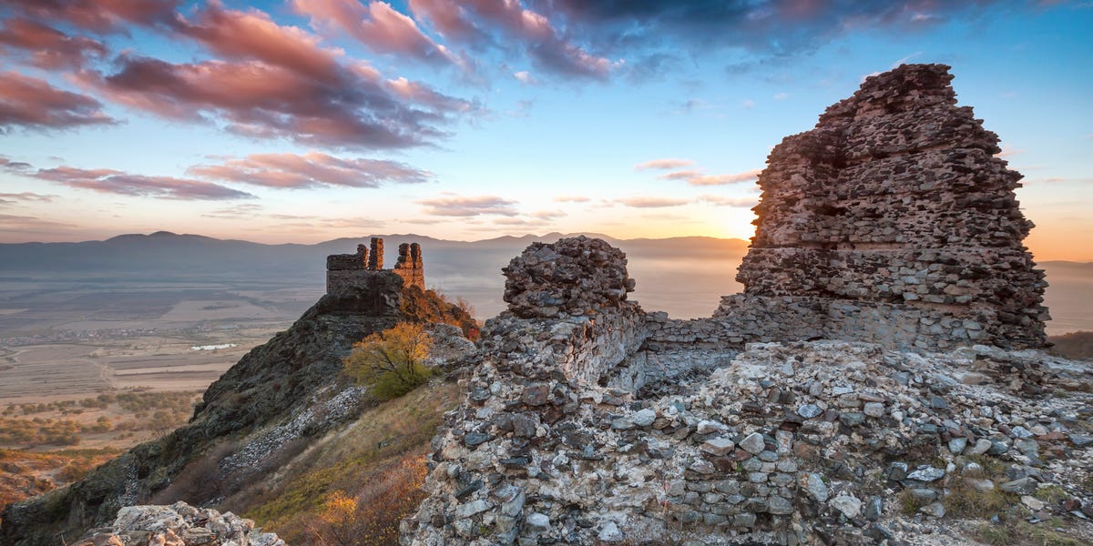
A fortress can be difficult to misplace. Walls stretching across a mountain plateau usually have a way of announcing themselves. Yet in southern Georgia, archaeologists discovered that a known Bronze Age stronghold had been hiding something spectacular in plain sight: most of itself.
The site, called Dmanisis Gora, sits on a naturally protected promontory in the South Caucasus. Researchers initially focused on its compact inner fortress, but drone mapping later revealed an enormous outer settlement, multiple defensive structures, graves, field systems, and a fortification wall approximately one kilometer long. The complete complex was more than 40 times larger than the area first examined. Suddenly, what looked like a respectable hilltop fort had become one of the largest known Late Bronze Age and Early Iron Age settlements in the region.
The discovery is not simply an archaeological version of finding an extra room behind the bookcase. Dmanisis Gora may change how researchers understand ancient settlement growth, mobile pastoral communities, defense, political authority, and the many ways people gathered before modern cities took shape.
What Exactly Did Archaeologists Discover?
Dmanisis Gora is located in the Kvemo Kartli region of Georgia, near the boundary between highland pasture and lower agricultural land. The South Caucasus has long served as a crossroads connecting Europe, the Eurasian Steppe, Anatolia, and the Middle East. During the period from approximately 1500 to 500 BCE, large fortified settlements began appearing across this culturally diverse landscape.
Researchers Nathaniel Erb-Satullo of Cranfield University and Dimitri Jachvliani of the Georgian National Museum began investigating Dmanisis Gora in 2018. Test excavations examined a fortified core positioned between two steep-sided gorges. Some sections of these natural ravines reach depths of about 60 meters, giving the settlement excellent defensive advantages without requiring ancient builders to construct every obstacle themselves. Nature had already completed part of the security system, apparently without submitting an invoice.
The inner fortress covers approximately 1.5 hectares and includes two substantial defensive walls, with another wall running between them. Archaeological excavation found buildings along the inside of the fortifications and evidence of multiple occupation phases.
However, the inner fortress was only the beginning. Beyond it, researchers eventually identified a vast outer enclosure containing hundreds of human-made features. These included rectangular and curved stone compounds, possible animal pens, probable burial structures, field boundaries, additional fortifications, and scattered architectural remains.
How Could a Mega-Fortress Remain Hidden?
The fortress was not buried beneath twenty feet of sand, sealed inside a jungle, or protected by an ancient curse with suspiciously specific instructions. Much of it was concealed by ordinary grass, uneven terrain, shallow soil, collapsed stonework, and the limitations of viewing a huge landscape from ground level.
During summer, knee-high vegetation made subtle walls and stone alignments difficult to recognize. When the research team returned in early autumn, after the grass had died back, they noticed structures extending well beyond the inner fortress. The newly visible remains suggested that the site was dramatically larger than expected.
Walking across the plateau still did not provide a clear picture. Ancient walls had collapsed into low ridges, natural bedrock could resemble masonry, and the site extended across dozens of hectares. From the ground, researchers were essentially trying to understand a giant floor plan while standing with their noses pressed against one corner of it.
The solution was to move the survey into the sky.
Drone Mapping Revealed the Fortress’s True Scale
Nearly 11,000 Aerial Photographs
The team used a DJI Phantom 4 RTK drone to photograph the fortress and surrounding landscape. The aircraft captured nearly 11,000 overlapping images across approximately 115 hectares. Photogrammetry software stitched those images together to create highly detailed orthophotos, digital elevation models, and hillshade maps.
An orthophoto corrects the distortions normally found in aerial photography, allowing researchers to measure distances and compare features accurately. The resulting imagery achieved a resolution of roughly one centimeter per pixel, while the drone’s real-time kinematic positioning system provided relative accuracy of about two centimeters or better. In archaeological terms, that is less “blurry treasure map” and more “the stones have nowhere left to hide.”
Ground-Truthing the Digital Evidence
Drone imagery alone cannot reliably determine whether every line is an ancient wall, a modern field boundary, or an inconveniently wall-shaped piece of geology. Researchers therefore inspected mapped features on foot. This ground-truthing allowed them to distinguish natural bedrock from human construction and classify uncertain features carefully.
The combined aerial and terrestrial survey identified hundreds of human-made remains. Nearly all the archaeological features outside the inner fortress had not previously been mapped.
Cold War Satellites Joined the Investigation
The researchers also compared modern drone imagery with photographs taken by declassified Cold War spy satellites during the 1970s. These historical images showed the landscape before decades of additional agricultural activity altered parts of the site.
By merging satellite photographs, drone models, ground observations, and Geographic Information System data, the team could separate ancient structures from more recent field systems and evaluate where plowing had damaged archaeological remains. Technology designed to watch geopolitical rivals had, decades later, found a second career examining Bronze Age walls.
How Large Was Dmanisis Gora?
The scale of the newly mapped complex is what earned Dmanisis Gora the description “mega-fortress.” Its complete outer fortification wall stretches approximately one kilometer from one gorge edge to another. The original wall may have measured roughly two to 2.5 meters wide, while its collapsed remains now form stone spreads approximately four to five meters across.
The complete wall encloses an area of about 56 hectares. Additional partial fortification lines extend the potentially defended plateau to roughly 80 hectares. Researchers describe the full fortress-settlement as covering approximately 60 to 80 hectares, compared with the 1.5-hectare inner fortress originally receiving most of the attention.
The best-preserved portion of the outer settlement occupies approximately 20 to 25 hectares. Evidence of damaged structures in nearby fields suggests that habitation may once have spread farther.
For perspective, the enclosed area approaches or exceeds the size of several major medieval settlements in the South Caucasus. The nearby medieval town of Dmanisi covered roughly 14 hectares, while historic Tbilisi and Ani enclosed areas in the range of approximately 65 to 80 hectares. Dmanisis Gora was not necessarily as densely populated as those later cities, but its physical footprint was astonishingly large.
When Was the Mega-Fortress Built?
Evidence from the inner fortress places its principal occupation around the transition from the Late Bronze Age to the Early Iron Age. Radiocarbon dates from its earlier phase point to the twelfth or eleventh centuries BCE. A charred seed recovered from a ceramic vessel in a burial dated to the tenth century BCE, while pottery suggests another occupation phase during the first half of the first millennium BCE.
Excavations have produced an enormous ceramic collection. More than 30,000 pottery fragments were recovered during the 2023 season alone, and over 50,000 fragments had been processed from the 2018, 2023, and 2024 excavations when the study was prepared. Most belong to the Late Bronze Age and Early Iron Age, although the site also contains traces of earlier and later activity.
The depth of archaeological deposits, abundance of pottery, and presence of pig bones suggest that the inner fortress supported permanent, year-round residents. The outer settlement presents a much stranger picture. Despite its walls and numerous stone compounds, it has relatively shallow deposits and very few surface artifacts.
Was It a City, Fortress, Refuge, or Seasonal Gathering Place?
The word “mega” may inspire images of a crowded ancient metropolis filled with markets, workshops, administrators, and someone complaining about chariot traffic. The evidence at Dmanisis Gora is more complicated.
The outer settlement contains compounds generally measuring between 15 and 40 meters across. Some were rectangular, others curved, and many were separated by open space. This low- to medium-density layout differs from the tightly packed blocks associated with many later Near Eastern cities.
Researchers therefore hesitate to call Dmanisis Gora a city in the conventional sense. Its area was city-sized, but its population density and occupation pattern may have been entirely different. One leading hypothesis proposes that the permanently inhabited inner fortress was surrounded seasonally by a much larger, mobile population.
A Hub for Mobile Pastoralists
Dmanisis Gora lies along a natural route between lowland and highland grazing zones. Pastoral communities moving livestock between seasonal pastures may have gathered at the fortress during spring and fall. The outer compounds could have accommodated families, herds, storage, exchange, ceremonies, and social activities during these temporary concentrations of population.
Under this model, the settlement expanded and contracted throughout the year. Its stone walls represented a major investment, but continuous occupation was unnecessary. A secure gathering place for people and animals could still justify large fortifications, especially in a landscape shaped by mobility, competition, trade, and occasional conflict.
A Short-Lived Settlement Experiment
Another possibility is that the outer settlement was an ambitious attempt to establish a large permanent community that never fully succeeded. The walls and compounds may have been constructed to encourage mobile groups to settle near the fortress’s permanent residents.
These explanations are not mutually exclusive. A community could have started as a seasonal gathering place, experienced efforts toward permanent occupation, and later returned to intermittent use. Archaeological settlements were rarely frozen in one tidy category, no matter how much modern humans enjoy labeling things.
What the Fortress Reveals About Ancient Power
The architecture of Dmanisis Gora required planning, labor, cooperation, and access to substantial resources. Yet the fortress core did not grow in direct proportion to the enormous outer settlement. That mismatch may be important.
If the central fortress represented administrative authority, storage, and elite power, researchers might expect a dramatically larger core to manage tens of hectares of settlement. Instead, the inner stronghold remained comparable in size to other regional fortresses. This pattern could indicate that people gathered through communal relationships, mutual protection, ritual obligations, trade networks, or seasonal traditions rather than being controlled by a powerful centralized state.
The distinction changes how archaeologists think about social complexity. Large settlements did not always require kings, bureaucracies, rigid street grids, and full-time urban populations. Some ancient communities may have created enormous gathering places while preserving substantial mobility and decentralized organization.
A Different Story From the Bronze Age Collapse
Around the twelfth century BCE, major societies across the Eastern Mediterranean and Near East experienced political disruption, population movement, warfare, and the decline of long-established urban centers. This broad transformation is commonly known as the Bronze Age Collapse.
The South Caucasus may have followed a different trajectory. Settlement patterns and material culture around Dmanisis Gora demonstrate notable continuity across the Bronze Age–Iron Age transition. Rather than simply collapsing, communities in the region may have adapted through fortified settlements, flexible pastoral networks, and seasonal forms of population aggregation.
Dmanisis Gora therefore contributes to a more nuanced understanding of resilience. When centralized systems elsewhere encountered instability, communities with mobile economies and adaptable settlement patterns may have responded differently. The fortress cannot explain the entire region, but it offers a valuable case study that does not fit the traditional collapse narrative.
Why This Discovery Matters for Modern Archaeology
The Dmanisis Gora research demonstrates that archaeological discovery is no longer limited to digging trenches. Excavation remains essential, but remote sensing can reveal the relationships between structures across entire landscapes before researchers disturb the ground.
Drones are particularly useful at large, rugged, or vegetation-covered sites. They can survey extensive areas rapidly, produce repeatable measurements, and create three-dimensional records that remain available after seasonal vegetation returns. Historical satellite imagery adds another layer, allowing archaeologists to examine landscapes before modern farming, roads, and construction altered them.
Just as important, the project combined technology with direct observation. Algorithms did not declare every suspicious bump an ancient palace. Researchers inspected features physically, documented ambiguity, and adjusted their interpretations. The result was not merely an impressive aerial photograph but a carefully verified archaeological map.
Similar methods could reveal additional fortress landscapes throughout the Caucasus. Dmanisis Gora may be exceptional, but researchers have identified other potential mega-fortresses whose size and internal organization remain uncertain because of sedimentation, agriculture, incomplete walls, or limited surveys.
Questions Archaeologists Still Need to Answer
The mapping project established the fortress’s size and general organization, but many mysteries remain.
Researchers still need stronger dates for the outer walls, compounds, and graves. The proposed connection between the inner and outer settlements is convincing but not conclusively proven. Excavation may determine whether different neighborhoods were constructed simultaneously or added over generations.
Future studies may also examine food remains, animal bones, ancient plant material, soil chemistry, microscopic residues, and the distribution of artifacts. These sources could reveal whether outer compounds served as homes, livestock enclosures, workshops, storage spaces, ceremonial areas, or a mixture of functions.
Additional research may clarify population size, livestock movement, agricultural practices, trade relationships, and the social connections between permanent residents and visiting pastoral groups. Ancient DNA and isotope analysis could potentially show where people and animals originated, although preservation and access will determine what is possible.
For now, the responsible conclusion is exciting but cautious: Dmanisis Gora was enormous, unusual, and socially important, but its complete story is still under constructionapproximately three thousand years behind schedule.
Conclusion: A Fortress That Changes the Archaeological Map
The discovery at Dmanisis Gora did not begin with a golden treasure, royal tomb, or dramatic inscription. It began with researchers noticing that the grass had changed and that a few low stone features extended farther than expected.
Drone mapping transformed those clues into a detailed picture of a 60- to 80-hectare fortress landscape. Its kilometer-long wall, double-defended core, scattered compounds, graves, and field systems reveal a community capable of organizing construction on an extraordinary scale.
More importantly, the site challenges the assumption that large ancient settlements must resemble conventional cities. Dmanisis Gora may have combined permanent occupation, seasonal migration, livestock management, ritual gathering, exchange, and communal defense. It was not necessarily a city, a military base, or a pastoral camp. It may have been all those things at different times.
The hidden mega-fortress reminds us that archaeological landscapes are not empty simply because their buildings are difficult to see. Sometimes an entire settlement is waiting beneath the grass, patiently hoping someone remembered to charge the drone batteries.
Experiencing a Discovery Like Dmanisis Gora: A Reconstructed Field Perspective
Imagine arriving on the plateau during the summer field season. At first, the landscape appears open and relatively quiet. Wind moves through tall grass, livestock graze in the distance, and scattered stones seem too ordinary to deserve much attention. The inner fortress is obvious enough: heavy collapsed walls occupy a naturally defensible position between deep gorges. Beyond that core, however, the plateau looks less like a lost metropolis and more like an excellent place to misplace a hat.
The experience changes when the grass begins to fade in early autumn. Low ridges appear beneath the vegetation. Some run in straight lines; others form circles, rectangles, or loose compounds. A wall seems to continue toward the gorge, then another line emerges farther away. The first emotional response is probably not instant certainty but suspicion. Archaeologists learn to distrust convenient shapes because geology, farming, erosion, and hopeful imagination are all talented impersonators.
Mapping the site on foot would be physically demanding and mentally frustrating. A feature that looks convincing from ten feet away may disappear when followed across uneven terrain. GPS points accumulate, notebooks fill, and the broader pattern remains elusive. Every hill produces another hill, every wall another possible wall, and lunch somehow remains several kilometers away.
Then the drone survey begins. From the ground, the aircraft is a small machine tracing repetitive lines across the sky. Its flight may not feel cinematic. There is no heroic soundtrack, and the drone operator is mostly watching batteries, coordinates, weather conditions, and data storage. Yet each flight captures hundreds of overlapping photographs that will eventually become something no person standing on the plateau can see: the settlement as a connected whole.
Back at the workstation, the photographs are processed into an orthophoto and digital terrain model. Gradually, faint stone lines become visible. The outer wall stretches between the gorges. Compounds fill areas previously dismissed as empty pasture. Graves, field systems, probable enclosures, and damaged structures emerge from variations in elevation measured in centimeters.
That moment would bring excitement, followed almost immediately by more work. Every feature must be checked. Researchers return to the plateau with maps, tablets, measuring equipment, and questions. Is that curved structure a burial monument or an animal enclosure? Is the gap in the wall an ancient gate or modern damage? Does a rectangular feature belong to the Bronze Age settlement or a recent agricultural building?
Field experience at a site such as Dmanisis Gora would also involve constant awareness of uncertainty. Archaeology rarely delivers complete answers in one dramatic afternoon. A wall can be mapped before it is dated. A building can be identified before anyone knows who used it. Tens of thousands of pottery fragments can establish chronology while refusing to provide the name of a single resident.
The most memorable experience may therefore be the shift in scale. What initially appeared to be a small fortified center becomes a landscape shaped by generations of movement, construction, burial, farming, defense, and seasonal return. The discovery is not a single object lifted from the soil. It is the realization that an apparently empty plateau once functioned as a vast human place.
That realization is both thrilling and humbling. Modern technology can reveal the outlines, but understanding the people who built Dmanisis Gora will require years of excavation, laboratory analysis, comparison, debate, and revision. The drone provides the wide view. Archaeology must still fill it with human lives.